Chat Plays GeoGuessr
an interactive Twitch extension to play GeoGuessr (or similar games) with your audience.#
source (frontend, backend)
but please don’t look too closely, the code sucks
FAQs:#
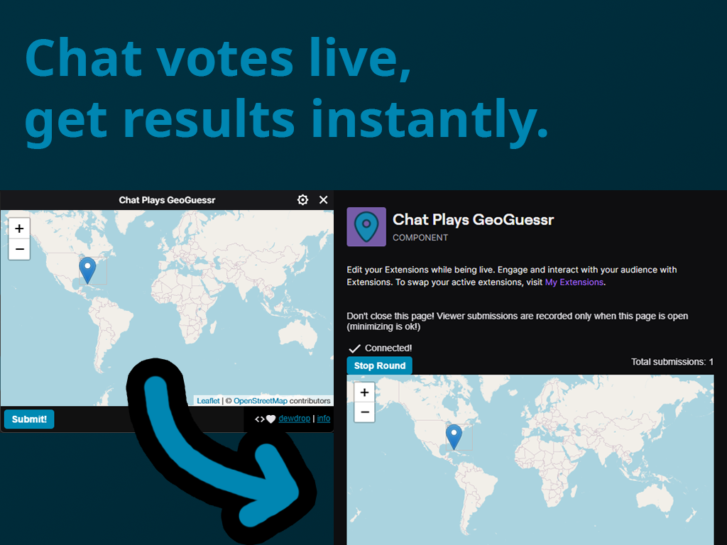
q: I’m a viewer, how do I use it?
a: Once the streamer starts a round, just pick your guess on the map, and hit submit!
q: I’m a streamer, how do I use it?
a:
- install the extension from the twitch extension marketplace here!
- from your creator dashboard, activate the extension (Creator Dashboard => Extensions => My Extensions) by picking a component slot to activate it in.
- from the Stream Manager, click the “Chat Plays GeoGuessr” button in your Quick Actions panel. a window should open.
- once the live config panel opens and the status indicates you’re connected, you can start a round.
- the marker on the map will update as viewer submissions come in. (note: if you close the live config panel, the round will be stopped, and current votes will be deleted.)
- once enough time has passed, you can stop the round. this prevents the marker from moving further.
- enjoy!
q: does this extension automatically submit guesses on geoguessr for me?
a: no. the broadcaster will need to take the position from the map, and submit it on the geoguessr game manually.
q: where do I send bug reports/feedback?
a: email me the details at geoguessr@dewdrop.dog! please include as much information as possible - when, what channel, what you were trying to do, what any error messages said, and what you were doing preceding the error.
q: I have money I’d like to give you!
a: not really a question, but thanks! the server costs money to host, and if you’d like to help make it more reliable, chipping in on my ko-fi is super appreciated!
q: wait, how are you averaging the guesses? you can’t just average the latitudes/longitudes, since that would throw things off near the poles and international date line!
a: wow, sounds like someone read this gis stackexchange post! but that’s correct, submitted latlngs are first converted to cartesian coordinates. these can be summed and converted back to a latlng for rendering on the map.